
The Tatra Mountains, which occupy an area of 785 sq. kms. are a mountain range that form a natural border between Slovakia and Poland. The mountains together with the Tatra National Park ( Tatzanski Park Narodowy) boast of having lots of lakes, peaks and amazing views. The park itself, which has the status of UNESCO Biosphere Reserve, protects the highest mountains in Poland and stretches over the entire area of the Tatras. There is a total length of 275 kilometers of signed walking and hiking trails in the Tatra mountains, which make the area a paradise for active holiday goers..

I. THE CITY OF ZAKOPANE
Zakopane, which lies in the valley between Tatra Mountains and Gubalowka Hill , is the highland capital of Poland and also considered as the winter capital of Poland. It is a very popular destination for skiing, hiking and mountaineering. Zakopane is also renowned for the numerous authentic wooden buildings with distinctive features such as delicate wood carving decorations, steep shingled roofs and huge attics and verandas.The city offers also lots of shopping and dining opportunites for tourists. Hans and I spent quite some times in exploring the city, walking from the parking area up to the most famous high street in the city, the Krupowki Street.


It was late in the afternoon (Friday, August 20, 2016) when we arrived in Zakopane. We first tried to park in the paid parking area near the cable car station in Kuznice. But at 9 in the evening, the guard of the parking informed us that it was not allowed to stay the night there. He then led us to an open area just nearby the parking.
Campsite : M. Karlowicza 16
Kuznice (Zakopane)
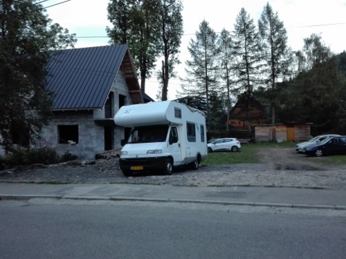
It was not an official parking area. It was just an open area next to a construction site. Fee was 20 zloty/day. It was about 1.5 kilometers from the cable car station to Kasprowy Wierch. We stayed here for three days.
II. HIKING AT THE TATRA MOUNTAINS
We have prepared ourselves quite well before we went to Zakopane. We bought a small guidebook about the area and the mountains and studied the different hiking trails in it. We selected a few which we thought were doable. These included a hike to the different peaks and to Morskie Oko. It was such a bad pick as we underestimated the distance, height, and the difficulty of the hike. In the end, we were only able to hike three of its peaks and the the Giewont.
A. HIKING THE THREE PEAKS
There are many high peaks in the Tatra Mountains, waiting to be conquered. The highest peak in the Polish side is Rysy which is 2499 meters high! Well, that was not in our list as we have heard that it was very far and very difficult hike; something for really experienced hikers, which we are not! We just planned to hike three peaks : The Liliowe (1952 meters high), Swinicka Przelecz (2051 m) and Swinica (2301 m).
On the day of our hike (Saturday August 21) , we were already up at 5.30 on the morning. We were never up so early before. But a hiker whom we talked to the day before advised us to start as early as 6 in the morning as there was always a long line to the cable car in going to Kasprowy. He experienced standing in line for 2 hours just to have a ticket. So there we were, two early birds at 5.30. After a quick breakfast and preparing our packed lunch and drinks, we walked about 1.5 kilometers to the cable car station (which lies at 1101 meters high). The cable car would take us to Kasprowy Wierch which is 1987 meters high. From there, one can follow various hiking routes depending on one’s condition. Ticket cost 69 zloty (park fee included). Hans had a discount of 10 zloty. It is also possible to hike up there, but it would just make the hike a lot longer and tiring.
The transport with the cable car was approximately 15 minutes; we stopped at the height of 1333 meters where we had to change from car and then went through to Kasprowy Wierch.


It was still quiet in the wierch as it was it was only 7.30. It was beautiful up there! The views were amazing. After looking around and drinking coffee, we started our hike. We first went up a little higher to the Weathe Station, and then we went down again and took the path less-travelled, following the Yellow Trail. We went down at 1800 meters up to Gasiennicowa, then we we turned right and followed the Black Trail. We slowly went up again, passing a very beautiful lake. Really, the view here was amazing! Afterwards, we followed a quite tricky trail. It was steep and narrow. But the higher we got, the more beautiful views we had! Finally we reached the first peak : The Swinicka Przelecz which is 2051 meters high.


The next goal is to go to Swinica which is 2031 meters high. Again, the path was tricky, steep and more dangerous. And all the time we had grand views of the Tatra mountains. Really undescribable! What a beauty!


But wait! The way to the next peak became more difficult. There were steel chains to hold on to. As I saw where we were going and what for danger awaited me in hiking to the next peak, I chickened out! I got cold feet. My knees shook a lot. After deep thoughts, I decided to quit! Yes, I quit. I turned around and retraced my steps. I just couldn’t make it. I was too afraid. And Hans went with me. We just chose a nice spot along the trail and observed those courageous hikers hanging on to their lives. Deep respect for their courage!


After a while, we continued our hike back to Kasprowy Wierch. We passed at another lower peak, the Liliowe which is 1952 meters high. We stopped here for a while and enjoyed from the wonderful views. Then we decided to stay a bit at Kasprowy and finally, took the cable car in going down.


It was about 15.30 when we returned at the station, and even at that time, there was still a long line of tourists who wanted to go up. The different souvenir shops were also already open. So Hans and I spent some time in going from one shop to another. I bought one nice red Polish scarf. We then walked back to the camper, following the path along the river. It was 17.00 when we finally reached the camper. It was a long tiring day; but also memorable and delightful one.
B. HIKE TO GIEWONT
It is one hike after another. After the hike to three peaks, we did another hike the following day. This time, it was to Giewont. Giewont, which lies 1895 meters high, is the most famous peak in Zakopane area. The hike to Giewont begins in Kuznice by the cable car station. It takes about 5 hours to finish this somewhat moderately difficult hike.
Because we have seen in the internet that it would rain in the afternoon, Hans and I started our hike early that day (Sunday). We brought our raincoats with us , just in case. We started at the cable car station, and from there we followed the Blue Trail. The hike to Giewont is estimated to take at least 3.15 hours. We paid 5 zloty as park fee. It was at first a nice path; we even saw the cable car passing by. After an hour, we reached the Kondratowa Tourist Hut which lies at 1333 meters height. We stopped here for a while, went inside the cozy tourist hut and ordered 2 cups of coffee.


After a while, we continued our hike. It was gradually becoming steep; and the views were becoming more astonishing. We walked past the Kondratowa Valley until we reached Kondracka Przelecz , at the height of 1725 meters high. The Giewont cross was already visible at this point. We stayed here for about 15 minutes.


After a while, we hiked up again. We had to hurry as the sky was becoming darker. Maybe it was really going to rain. We finally reached the top of Giewont after another half an hour of hiking. But not without first passing through the most difficult part of the hike where we had to hold on to steel chains again and really be careful. I couldn’t back out at this time, because to do so, it would mean that the many hikers behind me would have to turn aside first to let me pass. And that would be really difficult. So I just gathered all my courage and went ahead.
We were on top of Giewont! We even climbed a little to the cross. The cross , which weighs 1900 kg, and is 15 meters high, is the landmark of Giewont. It is listed as one of the protected monuments in the Tatra Park. It was quite busy at the peak. It was narrow, and the hikers were just about everywhere! There was a magnificent views of the park, just like everywhere else in the mountains.


Because we were beginning to feel some raindrops, we decided to hike back again. The hike back was also dangerous. It was another path on the other side of the, but equally steep. Anyway, we managed to survive all the dangers.


We continued our hike back, following the Red Trail to Dolina Strazyska. Not long after, it rained! We put on our raincoats and just continued on hiking down. After about 2 hours, we reached Dolina.


The rain has stopped by then. There was a tourist hut in the clearing and it was busy with day tourists. We followed an even path along the river and after more than an hour, we arrived at the bus stop.


We took the bus, paid 7.50 zloty for both of us and got our of the bus station. We then walked to Krupowki street, the main street in Zakopane, entered one of the local restaurants and treated ourselves with a sumptuous dinner. It was great! After dinner, we have wanted to explore more of the city. But again, rain prevented us from doing so. It rained again, and hard! We had no choice but to walk back to our camper. We spent the rest of the evening, resting and planning our next adventure to the unknown….to Czech Republic. Our Poland adventure ended here in Zakopane…And what a wonderful way to end it!
Our customary pictures together


First hiking day


Second hiking day
